 817
817会议名称:“2025世界木材日”研讨会暨第七届国际林联(IUFRO)林产品文化研究组讨论会
会议时间:2025年3月18日
报告嘉宾: Habito DL Consuelo
嘉宾单位:菲律宾开放大学
报告摘要:
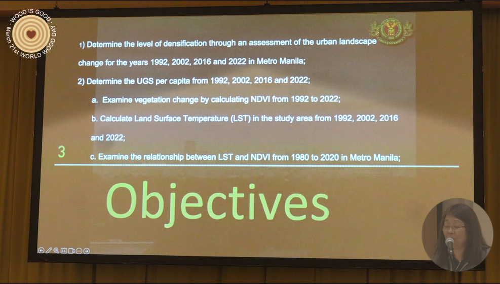
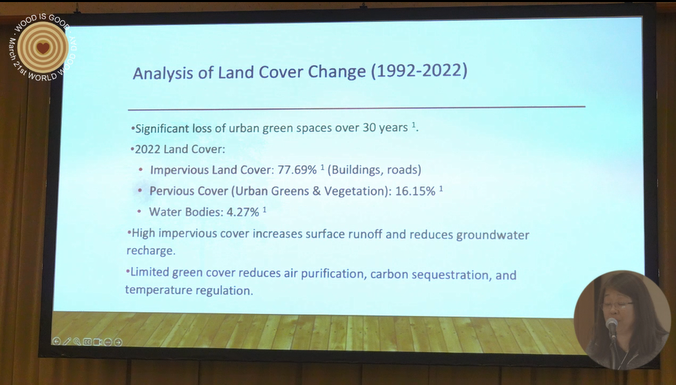
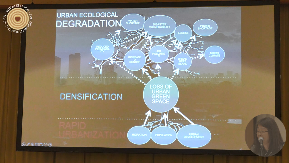
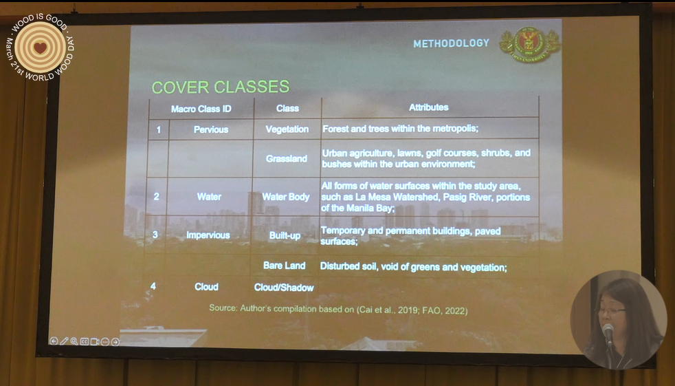
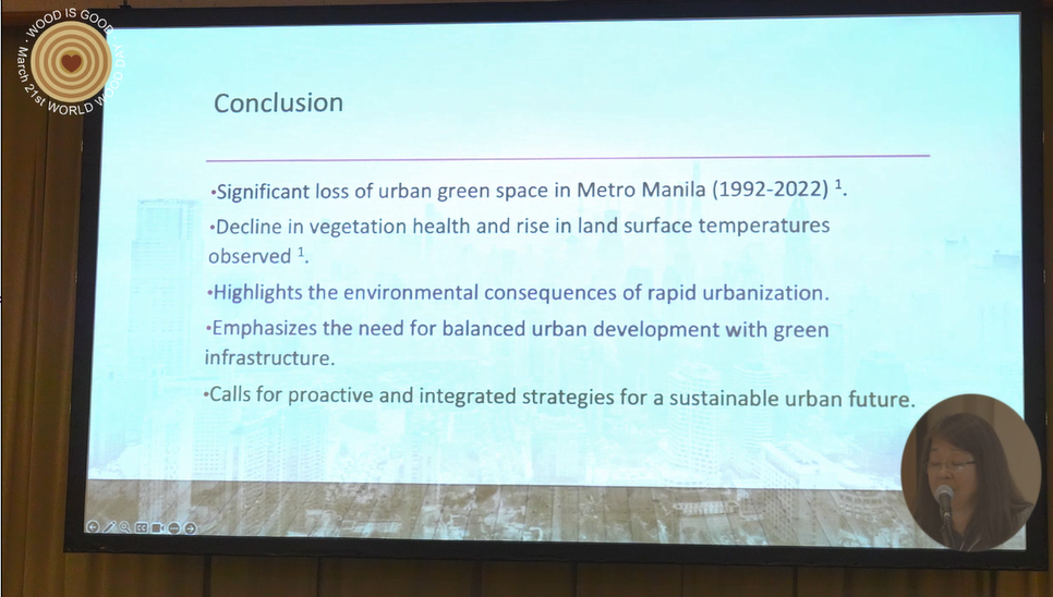
Densification and the compact city model have been inevitable consequences of urbanization. The preservation of urban green spaces and the need to incorporate the natural landscape into urban planning actions highlight the importance of rapid assessment methods that precisely diagnose the state of the landscape. The information generated can feed into objective environmental assessment, territorial planning, and decision-making.This study focused on the dynamics of landscape change in Metro Manila from 1992 to 2022. Using spatio-temporal analysis and remote sensing, specific environmental and socioeconomic variables to define Metro Manila’s state of densification were correlated. Results showed an overall loss of urban green spaces within Metro Manila. The normalized difference vegetation index (NDVI) from 1992 to 2022 showed a reduction in the overall health of urban greens to -0.037 while the average land surface temperature (LST) increased by +1.60°C. Correlation analysis showed a statistically significant relationship between the dynamics of pervious surfaces to the amount of construction (r=0.97, p .05) as well as a strong negative relationship between an increase in LST averages and reduction of water cover class construction (r=-0.99, p .05). There were positive correlations with Patch Density (PD) and Number of Patches (NP) (r=1.0, p. 05); Total Edge (TE) and Largest Patch Index (LPI) (r=.73, p .05); as well as AREA_MN and LPI (r=.99, p .05). Conversely, negative correlations between TE (r=.67, p .05) and Edge Density (ED) (r=0.67, p .05) denoted a fragmented landscape. Utilization of these data for management decisions is crucial for enhancing the city’s resilience in the era of climate change.
责任编辑:iwcs25H